Routes
Czech Mountain Routes: A Practical Guide
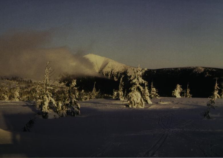
An overview of the main hiking areas in the Czech Republic — Krkonoše, Jeseníky, Šumava, and the Moravian-Silesian Beskydy — with route characteristics and access notes.
Read Article
Route notes, terrain descriptions, gear considerations, and safety awareness for walkers in Krkonoše, Jeseníky, Šumava, and the Beskydy.
Browse Routes AboutArticles
The Czech Republic holds several distinct highland areas worth knowing in detail before setting out. What follows are route notes, gear assessments, and terrain-specific safety considerations based on local conditions.
An overview of the main hiking areas in the Czech Republic — Krkonoše, Jeseníky, Šumava, and the Moravian-Silesian Beskydy — with route characteristics and access notes.
Read Article
What to carry into Czech highland terrain — footwear, layering, navigation tools, and weight considerations for day hikes versus multi-day routes.
Read Article
Weather patterns, trail marking conventions, emergency contacts, and terrain hazards specific to moving in Czech mountain areas throughout the year.
Read ArticleMountain Terrain
Four distinct mountain systems, each with its own trail network, elevation range, and seasonal character. Understanding the differences matters before choosing a route.
Key Areas
The highest range in the country, straddling the Czech-Polish border. Sněžka dominates the skyline at 1,602 m. The ridgeline trail — Hřebenová cesta — runs for roughly 30 km and is well-marked. Lower slopes hold dense spruce forests; the summit plateau is alpine moorland exposed to rapid weather shifts.
Praděd at 1,491 m is the highest point of Moravia and Silesia. The range is quieter than Krkonoše and offers long ridgeline walks with wide views. The Ramzovská plateau provides good cross-country touring ground in winter and open meadow walking in summer.
Šumava is characterised by plateau topography, glacial lakes, and extensive peat bogs rather than dramatic peaks. Boubín and Plechý mark the high points. Much of the interior is restricted wilderness; walkers follow designated corridors and boardwalk sections across the bogs.
The Beskydy run along the Moravian-Slovak-Polish border. Lysá hora at 1,323 m is the dominant summit. The range is heavily forested with well-developed tourist infrastructure — mountain huts, marked circuits, and a cable car on Pustevny ridge.
Contact
Questions about specific routes or terrain conditions can be sent using the form below.